Igneous rock makes up about 90 percent of Earth's crust. Most of it sits under soil, other rock, or ocean, which is why you rarely notice any of it. The classroom rock cycle diagram leaves that out, and it leaves out the part that costs marks, which is that the arrows going around the loop are optional.
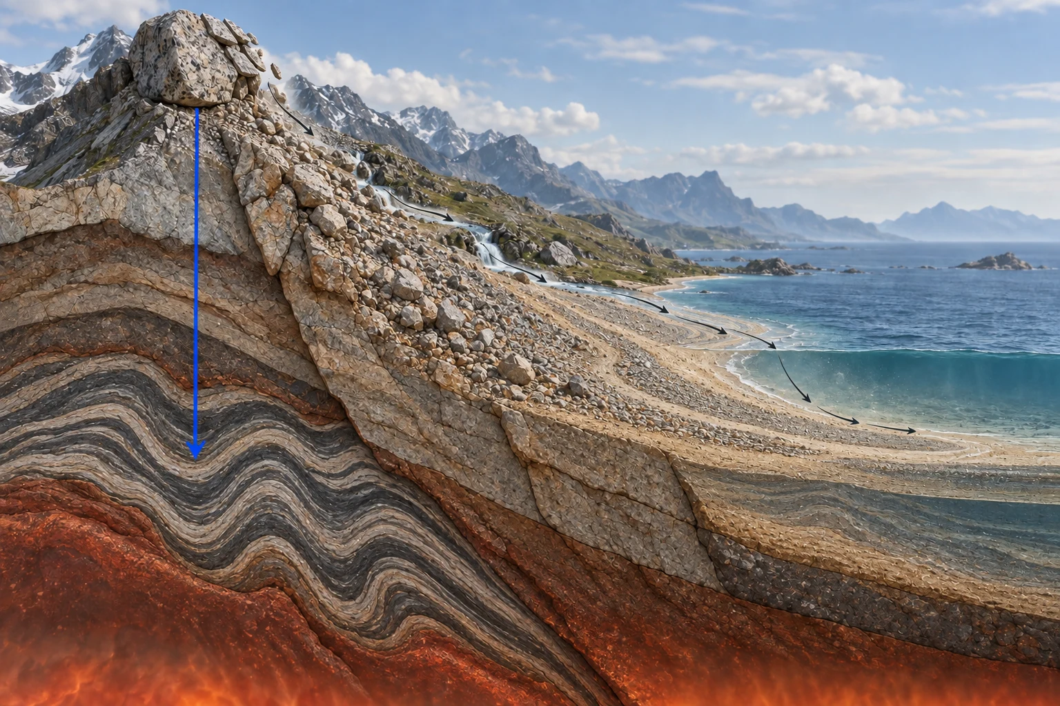
Igneous rock can become metamorphic without ever spending a day as sediment. Metamorphic rock can melt and come back as igneous. Sediment can erode, travel, settle and harden into another sedimentary rock without changing category at all. Memorize the loop and you've memorized a picture of the cycle. The exam asks about the paths.
This guide follows rock the way rock travels, covers the minerals underneath it and the forces that push it around, and links a generator for every piece you have to drill.
Did It Cool, Settle, or Get Squeezed?
Classification is one question asked three ways. Magma or lava cooled into it, so it's igneous. Loose grains piled up and cemented, so it's sedimentary. Heat and pressure rebuilt an existing rock without melting it, so it's metamorphic.
| Type | How it forms | The tell in your hand | Examples |
|---|---|---|---|
| Igneous | Magma or lava cools and solidifies | Interlocking crystals, no layering | Granite, basalt |
| Sedimentary | Grains compact and cement, or organic remains accumulate | Visible layers, often visible grains and pores | Sandstone, limestone, coal |
| Metamorphic | Existing rock recrystallizes under heat and pressure, never melting | Banding, or a hard dense streaky look | Gneiss, marble, slate |
Cooling speed writes itself into the rock, and that's the most useful line on the table. Granite cools slowly deep in the crust, so its crystals have time to grow large enough to see without a microscope. Basalt is similar material erupted onto the surface, cooled in the open, and its crystals never get past fine grain. Hold both and you can read where each one hardened.
Color is the second read. Light rock rich in silicon and aluminum is felsic, granite being the standard case. Dark rock heavy with magnesium and iron is mafic, which covers basalt and most of the ocean floor. Heavier minerals crystallize deeper and come out darker, lighter ones form nearer the surface, so color works as a rough depth gauge before you test anything.
The Igneous, Sedimentary, and Metamorphic Rock Classification Practice Generator drills this from written descriptions rather than photographs, which is how it appears on a test anyway.
Follow One Rock and the Loop Falls Apart
A Crash Course Geography episode tracks a single chunk of granite in the Himalayas from magma to boulder, and the trip looks nothing like the diagram.
Sixty million years ago the Indian plate sat about 6,400 kilometers south of Eurasia. As it drove north, the Tethys Sea between them was dragged under the Eurasian plate, and the seafloor sediment went down with it and melted. That magma pushed into cracks deep in the crust, cooled slowly, and hardened into granite. Mountain building lifted it. Weathering stripped off whatever had covered it.
Then the granite starts coming apart two ways at once. Pressure at the surface is far lower than where it formed, so the outer centimeters expand, crack, and slough off in sheets like a snake shedding skin. Temperature swings loosen individual mineral grains, which geologists call granular disintegration, and those grains pile up around the base. Rain moves them into a stream and the stream moves them toward the sea.
Centuries of monsoon erosion have put up to 20 kilometers of Himalayan sediment on the floor of the Bay of Bengal. Part of that boulder is down there right now, compacting toward sandstone. Another part of the same rock, caught in the collision zone and squeezed without ever melting, can recrystallize into gneiss and its alternating light and dark bands.
That's one rock with three futures running at the same time, and none of them is the loop. Nothing about the trip required a full circuit. The granite never became sediment before it became gneiss, and the sandstone forming offshore may never meet heat or pressure again.
Which is why a random-path drill beats redrawing the diagram. The Rock Cycle Practice Generator hands you a starting rock and an ending rock and makes you name the processes between them, including the pairs the memorized circle never connects. It builds rock cycle worksheet questions too if you want them on paper.
Minerals First, Then the Rock Has a Name
A mineral is a naturally occurring inorganic compound with a crystalline structure. A rock is a solid collection of minerals. Students trade the two words freely and then lose marks on identification questions, because those questions are mineral questions.
| Property | What you do | What it tells you |
|---|---|---|
| Hardness | Scratch it against known materials, Mohs 1 to 10 | Talc smears at 1, diamond cuts everything at 10. A fingernail is about 2.5, a steel file about 6.5 |
| Streak | Drag it across unglazed porcelain | The powder color, which holds steady even when the surface color doesn't. Hematite looks silver or red and streaks reddish brown either way |
| Luster | Look at how it returns light | Metallic or non-metallic first, then glassy, waxy, pearly, dull |
| Cleavage | Break it and read the new faces | Flat repeating planes mean cleavage. Curved or ragged means fracture |
| Specific gravity | Weigh it dry, then weigh it submerged | Density against water. Quartz sits near 2.65 and galena near 7.5, a gap you can feel in your palm |
Run the scratch tests with the Mohs Hardness Scale Mineral Identification Practice Generator. For the properties people judge by eye and misjudge by eye, there's the Mineral Streak, Luster, and Cleavage Identification Practice Generator.
Specific gravity is the property most people skip, because it needs arithmetic instead of a scratch plate. It's also the one that separates minerals that look identical. The Density Formula Solver handles mass over volume, and the Specific Gravity Formula Solver takes it to the ratio against water that mineral tables list.
Identification is cross-referencing, and the cross-reference gets long. Five properties, a dozen candidate minerals, one column that finally rules out everything else. Put it somewhere you can add a row to. A Dock Editor document with a line per sample beats a lab notebook margin, because the property that settled the last identification is usually the property that settles the next one.
Everything Above Ground Is Coming Apart
Weathering breaks rock where it sits. Erosion carries the pieces off. Deposition drops them somewhere new, and most of the marks lost on this topic come from mixing up which word covers which stage.
Water does most of the work. It dissolves nearly anything given enough time, freezes in cracks and levers them wider, and carries the debris downhill. Physical weathering changes the size of the pieces. Chemical weathering changes what they're made of, turning feldspar into clay and hollowing limestone into caves. The Weathering, Erosion, and Deposition Practice Generator sorts scenarios into the right stage, which is the entire skill being tested.
Soil is what weathering leaves once biology moves in, with the decomposers from every food web doing the mixing, and it stacks into horizons you can read off any road cut. O on top is organic litter. A is topsoil with humus mixed through it. E is the leached layer where water has stripped the minerals out. B is where those minerals collect. C is broken parent rock and R is the parent rock itself. Label them in order with the Soil Horizon Classification Practice Generator.
The Engine Is 2,900 Kilometers Down
Earth is layered by density, and those layers explain the surface. Continental crust is light-colored rock rich in silicon and aluminum, thick but the least dense solid layer. Oceanic crust is dark and iron-rich, denser, and only a few kilometers thick. Under both, the mantle runs roughly 2,900 kilometers and gets denser with depth as pressure packs it tighter. The outer core is 2,400 kilometers of molten iron. The inner core, radius about 960 kilometers, is iron as well, and it stays solid because the pressure down there won't let it melt.
Nobody has been to any of it. The structure comes from seismic waves. Earthquakes send them through the planet, different materials bend and slow them differently, and the arrival pattern at stations worldwide maps the interior. Those same recordings feed the magnitude scales, which the Earthquake Magnitude Scale Solver works through. Interior structure and seismology are one topic taught as two, so run the Layers of the Earth Practice Generator alongside it.
Above the mantle the crust is broken into plates that move independently, and the boundaries between them are where geology gets loud. Plates pulling apart build new crust at ridges. Plates colliding raise mountains, or drive one plate under the other and melt it, which is exactly what happened to the Tethys seafloor. Plates grinding past each other store the stress that earthquakes release. The Plate Tectonics Boundary Types Practice Generator works the three boundary types against the landforms each one produces.
Volcano shape follows magma chemistry, which makes it one of the few things here you can predict rather than memorize.
| Volcano | What feeds it | Shape you get |
|---|---|---|
| Shield | Runny mafic lava, little trapped gas | Broad and low, spread wide. Hawaii |
| Composite | Sticky felsic magma, trapped gas, violent eruptions | Steep layered cone. Fuji, St. Helens |
| Cinder cone | One vent throwing fragments | Small steep pile around a single hole |
Sort them with the Volcano Types Practice Generator.
How to Read a Contour Line in One Rule
Every contour line joins points at a single elevation. Everything else on a topographic map follows from that. Lines packed close together mean steep ground and lines spread apart mean gentle. A closed loop is a summit, unless it carries tick marks pointing inward, which makes it a depression.
One rule is worth knowing cold. Contours crossing a stream bend upstream into a V, so the V points uphill. That tells you which way the water runs on a map that never labels it. The Topographic Map Contour Line Reading Practice Generator builds elevation and slope questions off exactly that.
Four and a Half Billion Years, Chunked
Earth solidified about 4.5 billion years ago out of a collapsing cloud of dust and gas, the same kind of nebula that opens the life cycle of a star. The Himalayas began rising 60 million years ago, which sounds ancient and covers roughly the last 1.3 percent of the planet's history.
You can't reason with those numbers directly, which is why the geologic time scale exists. It cuts the history into eons, eras, periods and epochs, with boundaries set at events preserved in rock, mostly mass extinctions and the fossil turnover that follows them. Memorizing the sequence is the standard assignment and the standard place people stall. The Geologic Time Scale Practice Generator works the relationships instead, which period follows which, what defines each boundary, and which fossils place a layer in time. Fossils give the order, and the ages in years come from radioactive decay, the half-life math physics class teaches.
That last one runs back to the Bay of Bengal. Sediment stacks oldest at the bottom, the principle of superposition, so a core drilled through those 20 kilometers reads as a calendar of everything the Himalayas have shed.
There's a quick way to find out whether you know the cycle or only its drawing. Start at metamorphic, finish at sedimentary, and name every process in between without routing through magma, because that route isn't required. If the path stalls, the diagram taught you a shape rather than a mechanism. Drill the pairs the arrows skip. The generators for every step of it live in the education prompt library.